Get in touch > Contact Us Book a Demo Technical Support Book a Service
Pinpoint
Precision
HxGN SmartNet transforms the world’s largest reference network into a precise positioning service. HxGN SmartNet digitalises your business, opening it to new market opportunities and connecting it to parties not before accessible.
Any GNSS-device
Enabled
HxGN SmartNet is an open-standard correction service, able to use with any GNSS device, and is constantly monitored for integrity, availability and accuracy.
Continuous
Availability
HxGN SmartNet is provided 24/7 by a highly-available infrastructure and professional support team with more than 10 years of experience reliably delivering the service.
World's largest reference station network
HxGN SmartNet is the GNSS correction service built on the world’s largest reference station network, enabling GNSS-capable devices to quickly determine precise positions down to the centimetre.
Learn how HxGN SmartNet enables GNSS/GPS applications for surveying, construction, precision agriculture, mapping and GIS, and autonomy and robotics.
Surveying
Whether topographic, boundary, or as-built surveys, HxGN SmartNet allows you to achieve centimetre-level positioning for all your GNSS/GPS measurement and stakeout work.
View our Product Solutions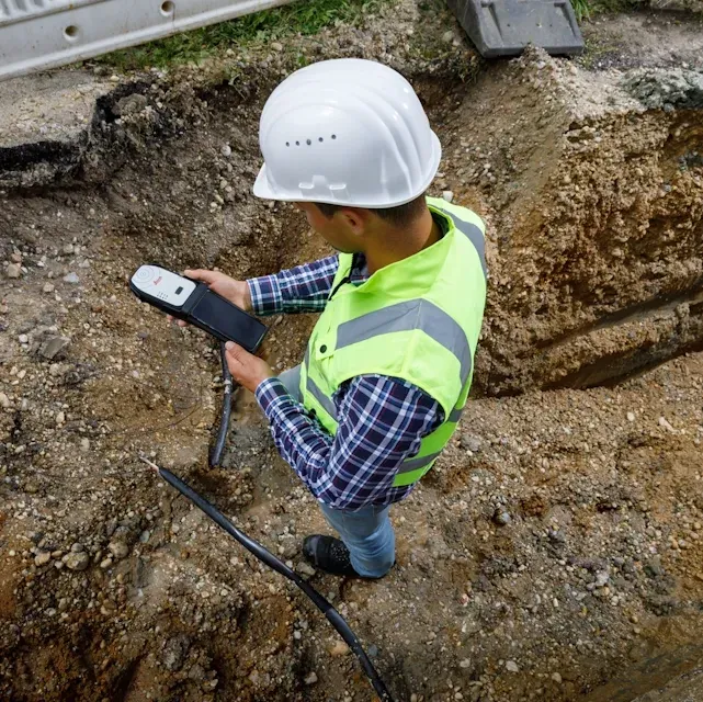
GIS & Mapping
From mobile mapping to GIS asset collection, create complete, precise data sets for your mapping projects and form the foundation for smart cities.
View our Product Solutions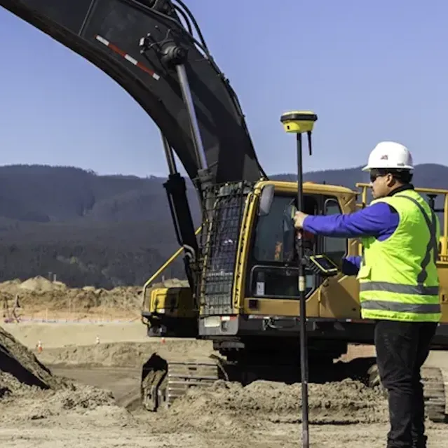
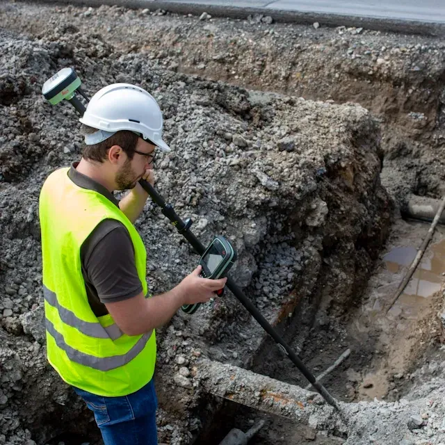
Building & Construction
Make the most of GNSS/GPS on your construction site with HxGN SmartNet, empowering precision for RTK rovers, machine control, layout, and drone site surveys.
View our Product Solutions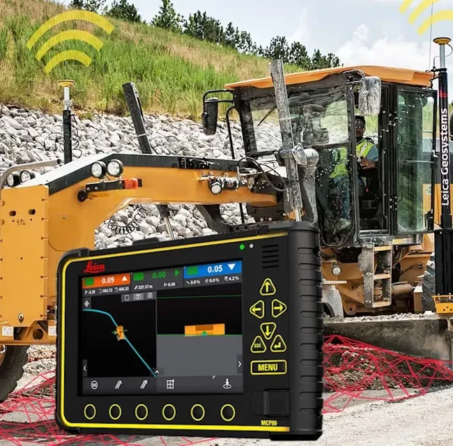
Earthmoving & Machine Control
Positioning and guiding excavators, bulldozers, graders, pavers, and more, HxGN SmartNet machine control solutions enable new heights of productivity, accuracy, and safety in construction.
View our Product Solutions
Precision Agriculture
Enable precision agriculture and smart farming for planting, spraying, and harvesting, gaining higher crop yields with fewer resources.
View our Product Solutions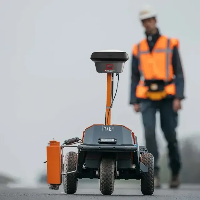
Autonomy & Robotics
From drones to self-driving cars and autonomous robotics for mowing, harvesting, marking and more, HxGN SmartNet empowers autonomous and robotic applications.
View our Product SolutionsHxGN SmartNet delivers high-precision, high-availability GNSS network correction services for any application in real-time and for post-processing with flexible subscription options.
NRTK services offer centimetre-level real-time corrections available on any GNSS device.
SmartNet Global products leverage Network RTK, precise point positioning (PPP), and RTK bridging technology to ensure global coverage, available on an expanding range of Leica Geosystems GNSS/GPS sensors and systems.
RINEX services ensure you have complete and accurate post-processing data and are easily integrated into office processing software.
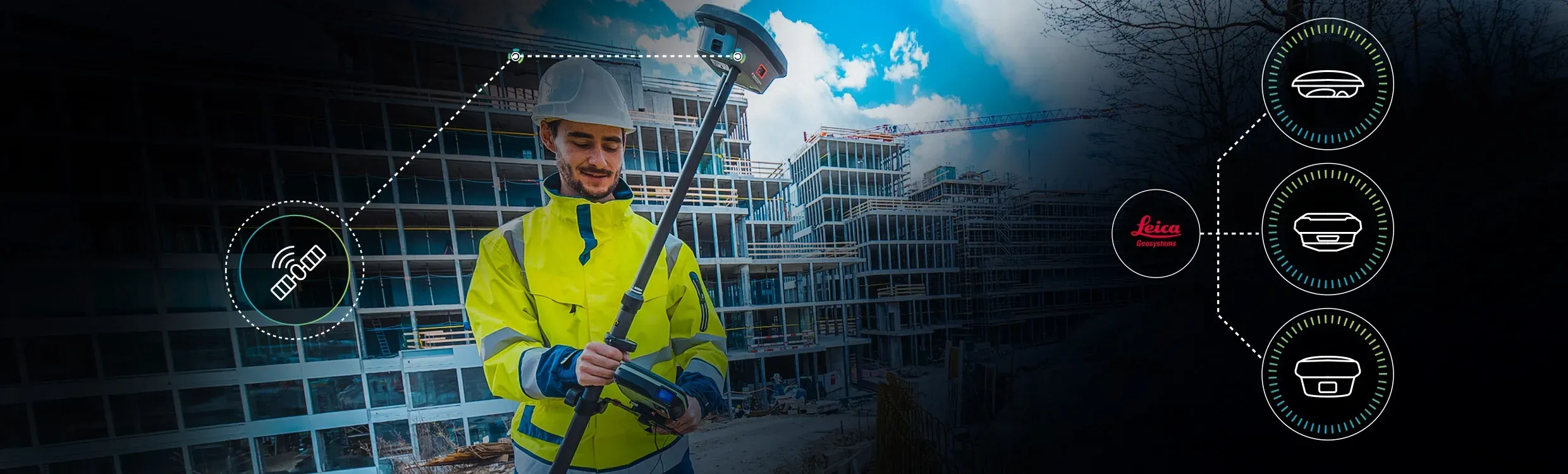
A growing range of industries and applications rely on GNSS/GPS for positioning. However, GNSS/GPS signals alone only provide accuracy at the metre level, and for many high-precision GNSS/GPS applications, this is simply not accurate enough. This is where HxGN SmartNet’s Network Real-Time Kinematic (RTK) services come to the rescue. As an open-standard correction service that can connect with any GNSS/GPS device over mobile internet, HxGN SmartNet’s Network RTK enables high accuracy in seconds, enhancing positioning to the centimetre level. Constantly monitored for availability makes it a reliable solution for all location-dependent applications. With the most extensive and growing reference station network worldwide and a dedicated team to monitor it, HxGN SmartNet provides a reliable real-time kinematic corrections experience - simply connect and measure.
GNSS/GPS devices receive signals from several satellites to determine your location. These signals can be affected when passing through the Earth's atmosphere and by various environmental factors, leading to inaccuracies that leave positioning at the metre level. For high-precision applications, however, this is not accurate enough.
That's where real-time kinematic (RTK) comes in, improving the positional accuracy of GNSS/GPS rovers. GNSS/GPS satellites broadcast signals, sending data to reference stations and GNSS/GPS devices around the globe. Reference stations stream the GNSS/GPS data to the HxGN SmartNet data centres, which also receive approximate positions of GNSS/GPS devices.
This data is then processed, and HxGN SmartNet sends Network RTK corrections back to GNSS/GPS devices over the mobile internet. The corrected position is accurate down to the centimetre, providing HxGN SmartNet users with high accuracy and precision they can count on.
Our users receive correction data in an open standard format (RTCM) by connecting any GNSS/GPS-enabled device over the mobile internet. Since HxGN SmartNet’s open standards work with all GNSS/GPS devices, users benefit from one streamlined service across all their GNSS/GPS equipment. Additionally, depending on your industry application and required area of coverage, subscriptions are available for regional, country-wide, and continental use cases, giving you flexible coverage options that fit your business needs.

No matter where in the world you work, experience accuracy and availability with HxGN SmartNet Global corrections services. Every GNSS/GPS rover needs a correction service for centimetre-level accuracy during real-time work. For select Leica Geosystems smart antennas and receivers, the best choice is HxGN SmartNet Global. Exclusive to Leica GS systems, Leica iCON gps for machine control, and Leica Zeno smart antennas, SmartNet Global offers trustworthy correction services that are easily accessible and automatically enable the best possible accuracy everywhere. Leveraging Network RTK corrections, precise point positioning (PPP), and RTK bridging technologies, complete coverage becomes a global possibility. Integrated into your high-accuracy GNSS solution, SmartNet Global has you covered, everywhere.

| SmartNet Pro | SmartNet+ | SmartNet PPP | |
|---|---|---|---|
| Network RTK | ✔ | ✔ | ✖ |
| RTK Bridging | ✔ | ✔ | ✖ |
| Satellite-based PPP | ✔ | ✖ | ✔ |
| Global Coverage | ✔ | Limited to RTK area | ✔ |
| Best For | Maximum availability | RTK areas with interruptions | Remote/global work |
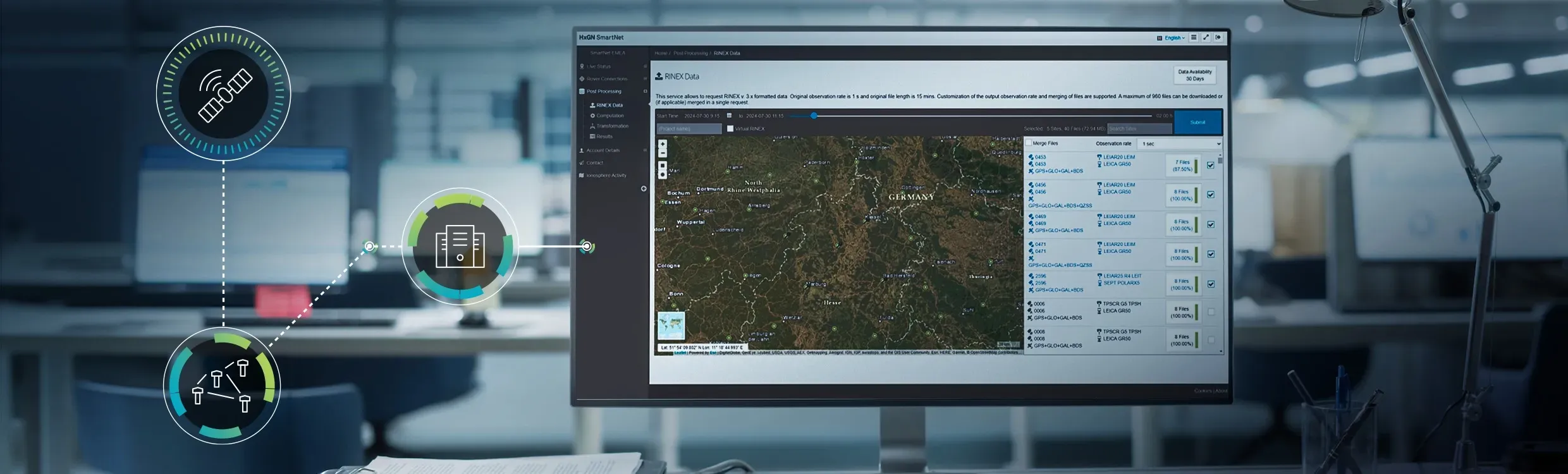
GNSS/GPS can be disrupted or unavailable for a range of reasons - poor internet connection, signal interference caused by terrain, vegetation, or urban canyons, and ionospheric activity. Receiver Independent Exchange Format (RINEX) data can fill any gaps resulting from these conditions, enabling corrections during post-processing. When coverage fails, you can still continue recording with your rover or drone and later use RINEX data with office software, like Leica Infinity, to apply precise corrections, improve measurement accuracy, refine flight trajectory data and imagery positioning, and more. Discover more about HxGN SmartNet's RINEX data services below, including options for single-country or continent-wide subscriptions and API integrations.
RINEX is a file format that stores GNSS observations received by the largest reference station network across the globe. RINEX data provides the foundation on which HxGN SmartNet is built, allowing us to bring our reference stations into the millimetre world. As a RINEX data subscriber, you can do the same.
During the post-processing stage, access to RINEX data files enables you to fill in coverage or communication gaps impacting real-time positioning accuracy. Having the most reference station network worldwide also means we have the most complete RINEX set globally and offer several ways of accessing and integrating the data into your workflow.

HxGN SmartNet's RINEX data service range enhances GNSS/GPS data post-processing workflows and is available in flexible subscriptions for a single country or continent level.

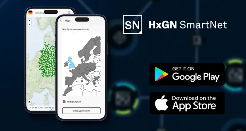
With HxGN SmartNet, we want to ensure you are empowered by accuracy and information. The HxGN SmartNet app keeps you connected to a live network status map of all the reference stations in our network and allows you to view your rover's position and status in real time. Additionally, you can test your connection to the Ntrip source table, create support tickets directly in the field, and access information about your subscription and quota consumption. Push notifications alert you to the latest general service news and network infrastructure updates - ensuring you have all the information you need to work without interruption. Simply download the HxGN SmartNet app and use your SmartNet user ID and password to login.


C.R. Kennedy is your national partner for all positioning needs from surveying to machine control, building construction to reality capture and everything in-between. Wherever you are in Australia, C.R. Kennedy are with you, providing an unparalleled level of service and support from industry experts to get the job done safely and efficiently.
Shop Safely and Securely with
@ C.R.Kennedy Geospatial Solutions
Our Brands
© 2026 C.R. KENNEDY. All rights reserved.
ICON SITE EXCAVATOR
SPECIAL OFFER - LIMITED TIME
A simple machine control solution ideal for compact excavators — with a big payoff!